SUSTAINABLE REGIONAL PLAN
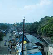
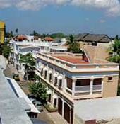
Puducherry
Viluppuram
Auroville
Cuddalore


Integrated Sustainable Regional Planning
India�s population grew from 290 million in 2001 to 377 million in 2011 (McKinsey 2010, Census 2011). According to the McKinsey�s report (2010) India will have 590 million (40 percent of the total population) people living in the cities by 2030, which is twice of United States Population today.
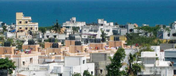
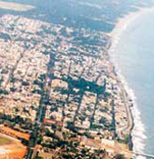
Our cities are expanding and their peripheries are engulfing the surrounding rural areas into the metropolitan boundaries. The metropolitan cities with a population of over 1 million have already increased from 35 in 2001 to 50 in 2011, and this number would continue to increase in the future. Tamil Nadu, Gujarat, Maharashtra, Karnataka and Punjab are expected to have over 50% of their population living in the urban areas. Puducherry is also rapidly expanding into its surrounding region, while blurring the distinction between urban and rural areas.
In view of this, INTACH Pondicherry and PondyCAN, with funding assistance from ADEME have embarked upon an initiative to develop a Model Inter-State Sustainable Regional Plan for Puducherry and its surrounding districts. This would help realize the full potential of the region in terms of: sustainable and balanced socio-economic growth, land use development patterns, multimodal connectivity, energy consumption, infrastructure provision and protection of natural resources.
Why develop a Sustainable Regional Plan?
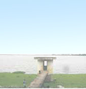
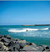
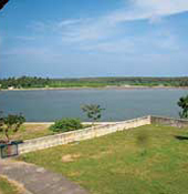
The wetlands of Puducherry and the surrounding districts of Viluppuram (including Auroville) and Cuddalore of Tamil Nadu constitute a distinct ecological bio-region. The topographically higher wetlands drain into lower wetlands till one reaches the coastal areas rich in bio-diversity. The whole region is part of an integrated natural ecosystem: along the coast are the beaches, sand-dunes, estuaries and mangroves. The natural backwaters and wetlands, along the sand dunes, arrest the water coming down the Deccan plateau through waterways, swales, and rivers. These backwaters play recharge the coastal aquifers, thus providing good ground water and also arresting any salt water intrusion that may occur from the seaside.
It is clear now that in case proper Regional Planning and an Integrated Growth Management framework is not put in place in Puducherry and its neighbouring Tamil Nadu districts immediately, rapid urbanization and haphazard growth will lead to land under agriculture being usurped for other urban activities. This will have a disastrous effect on the water systems of the area leading to increased runoff, deterioration of water quality and significantly reduced re-charging of aquifer.
A regional plan for Puducherry and its surrounding Tamil Nadu districts could evolve a new paradigm for development. The region is large enough to contain a substantial mix of economic activities, yet small enough so that relatively few changes to the natural and economic landscapes can produce observable trends. The experience gained from such an endeavour could motivate and encourage similar integrated development projects in other regions, giving a new direction to India�s growth, one that is sustainable and harmonious.
Plan Themes
In order to prepare the regional plan of Puducherry and specific areas of Viluppuram and Cuddalore districts of Tamil Nadu including Auroville, it is of vital importance to prepare an integrated framework in a scientific manner, based on the inclusive principles of a participatory planning approach with respective governmental and non-governmental agencies, private sector, and most importantly its residents. Keeping this over-arching goal in mind, the first phase of the Regional Planning Framework addresses the challenges and potential opportunities associated with the following four major themes - Land Use, Transportation, Energy, and Water.
LAND USE
Goals:
- Compact Urban Development Growth Centres
- Establish Urban-Rural Continuum
- Promote Sustainable Economy
- Protect Region�s Natural Assets
- Encourage Partnership between Urban and Rural Authorities
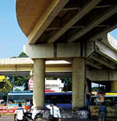
TRANSPORTATION
Goals:
- Increase Mobility and Accessibility of People and Goods
- Promote Sustainable Transportation Choices
- Promote Regional Public Transportation
- Integrate Transportation and Land Use Plans
- Identify Joint Infrastructural Improvement Opportunities
ENERGY
Goals:
- Create Awareness about Energy Efficiency Techniques/ Technologies
- Reduce, Reuse, Recycle Waste
- Use of Sustainable Sources of Energy
- Foster the Use of Cleaner, Quieter and Lower CO2, Road Vehicles
WATER
Goals:
- Improve Water Management Strategies Across the Region
- Create Awareness about Efficient use of Water
- Encourage Sustainable Water usage for Farming
Defining the Region
This Puducherry - Viluppuram � Auroville - Cuddalore Region for the first phase of this Regional Planning effort has been generally identified as the area bounded by the Kaluvelly Tank (Tindivanam taluk of Villupuram District) on the north, Coromandel Coast on the east and Perumal Lake (Kurinjipadi taluk of Cuddalore District) on the south. On the west, the Region�s boundary encompasses the Puducherry Urban Area and areas within the Villupuram taluk of Villupuram District that are a part of the 40 km radius drawn from the center of Puducherry. Puducherry, Cuddalore, Villupuram, and Tindivanam are the four major towns within the delineated bio-region covering a total area of 2,540 sq.kms.
WATER
Goals:
- Ongoing participatory workshops in Cuddalore, Viluppuram and Tindivanam
- Community surveys
- Capacity Building and Resource Mapping
- Formalize partnerships with Governmental Agencies, NGO�s and other institutions
- Action Plan
- Regional Plan Vision Document
To download regional plan report click here